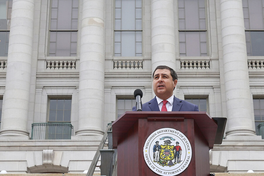
Washington State Governor Bob Ferguson has declared an emergency because of record-breaking flooding.
By the end of Thursday, there will be at least 300 members of the National Guard here to help with rescues and recovery.
You can watch the governor’s declaration here.
At 4:30 p.m., Ferguson wrote on X.com that 100,000 Washingtonians could be facing evacuation orders.
“The situation is fluid and changing all the time. We expect rivers to hit historic levels as early as 4 a.m. tomorrow, lasting into Friday morning,” he wrote.
Evacuation orders
Level 3 ‘Leave Now’ evacuation orders in Mount Vernon
The forecast: What to expect today
Rain and gusty winds will continue through this evening though the winds will start to taper off after about 8 p.m. But until then, fallen trees are possible with wind gusts over 40mph. The landslide risk is also very high with more rain that has fallen today.
Another 1-2 inches of rain in the lowlands could fall tonight through Thursday morning with more than five inches more in the North Cascades and two to three inches in the central and south Cascades.
Be very careful driving into tonight as the threat of landslides, fallen trees, and standing water will be present.
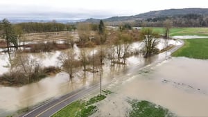
Flooding continues on all rivers in the area….some with record or near-record levels. The rivers presently forecast to reach record flood stage are the Skagit and Snohomish, though Snoqualmie Falls could reach record flood stage late tonight at a flow level over the Falls not seen since 1990.
The good news is the heavy rain will come to an end Thursday morning, though the waters on many of our river systems will continue to rise through Thursday, only falling on Friday into the weekend.
While the weekend’s weather looks calmer, there are prospects for more warm, wet, windy weather systems next week – possibly with some atmospheric river components. It appears that we won’t have an end to the flooding threat in Western Washington through next week.
KIRO 7 will have live team coverage of this ongoing flooding threat through the event. Stay with us on-air and online.
Rivers will rise throughout the day today, but the peak crests of most rivers are not expected until tomorrow. River levels into Friday will continue to be above normal, and there will be issues with urban flooding when the heaviest downpours hit today.
Major flooding is expected on many of our river systems with crests higher than what we observed on Monday and into Tuesday. Major flooding is expected on the following rivers with the following times of peak river levels (subject to change with new forecasts):
-
Snohomish River at Monroe: Major flood stage by Wednesday morning, peaking above record flood stage on Thursday.
-
Snohomish River at Snohomish: Rises rapidly Wednesday to major flood stage Thursday morning, peaking Thursday near record flood level.
-
Skagit River near Concrete: Major flood stage by late morning Wednesday with peak Wednesday night and Thursday morning well above record flood level.
-
Skagit River at Mount Vernon: Major flood stage by late Wednesday night, and above record flood level by late Thursday morning through much of Friday.
-
Stillaguamish River at Arlington: Rising into flood stage Wednesday morning, cresting near record Major flood stage Wednesday night.
-
Puyallup River near Orting: In Major flood stage from Wednesday morning to Thursday morning
-
Snoqualmie River near Snoqualmie Falls: Major flood stage from Wednesday morning to Thursday morning
-
Snoqualmie River at Carnation: Major flood stage from Wednesday afternoon to Thursday night
-
Tolt River at Carnation: Major flood stage from Wednesday morning to Thursday morning
-
Skykomish River at Gold Bar: Major flood stage from Wednesday morning to Thursday morning
-
Carbon River near Fairfax: Major flood stage from Wednesday afternoon to Thursday morning
-
Nisqually River near National: Major flood stage from Wednesday morning to Thursday afternoon
-
Cowlitz River at Randle: in Major flood stage now through Friday afternoon
-
Cowlitz River at Packwood: Major flood stage from Wednesday morning to Thursday morning
-
Cedar River at Renton: Rising into flood stage Wednesday afternoon peaking at near record flood stage Thursday morning
-
Elwha River at McDonald Bridge: Rising into flood stage Wednesday morning, cresting just above record Major flood stage Wednesday afternoon
-
Wenatchee River at Peshastin: Rising into flood stage Wednesday night, peaking in Major flood stage Thursday morning
Some minor coastal flooding is also possible, especially near the time of high tide and near where rivers empty into the Salish Sea.
As of 3:25 p.m., these new rivers are expected to reach record flooding.
Samish River near Burlington: Skagit River at Concrete and Mount Vernon
Stillaguamish River at Arlington: Snohomish River at Monroe and Snohomish
Cedar River at Renton
Wind Advisory
Adding to the weather mix for today — A Wind Advisory is posted and will be in effect through tonight. Wind gusts over 40 mph are possible all day, and the risk for falling trees is high. Heavy rain, high winds, flooding, and falling trees sum up the forecast today. Travel with caution.
What to expect later this week
Drier weather will be in the forecast from Thursday afternoon through Friday and the weekend, with most rivers dropping quickly into the weekend, though hazards will still remain, with debris and dangerous river currents.
While the weekend’s weather looks calmer, there are prospects for more warm, wet, windy weather systems next week – possibly with some atmospheric river components. It appears that we won’t have an end to the flooding threat in Western Washington through next week.
KIRO 7 will have live team coverage of this ongoing flooding threat through the event. Stay with us on-air and online at kiro7.com