- Much of India, including typically warmer southern regions, is experiencing unusually low temperatures.
- High-pressure systems, clear skies, low humidity, and northwesterly winds from central Asia are bringing cold air deep into the subcontinent.
- Arctic amplification, a weakening polar vortex, and La Niña are affecting wind patterns and contributing to the cold weather.
Much of India — including parts of south India — has been experiencing unusually cold weather in the new year, more notable compared to the typical January pattern. Experts attribute these conditions to local, regional and remote — from the Arctic to the Pacific — influences and climate change patterns.
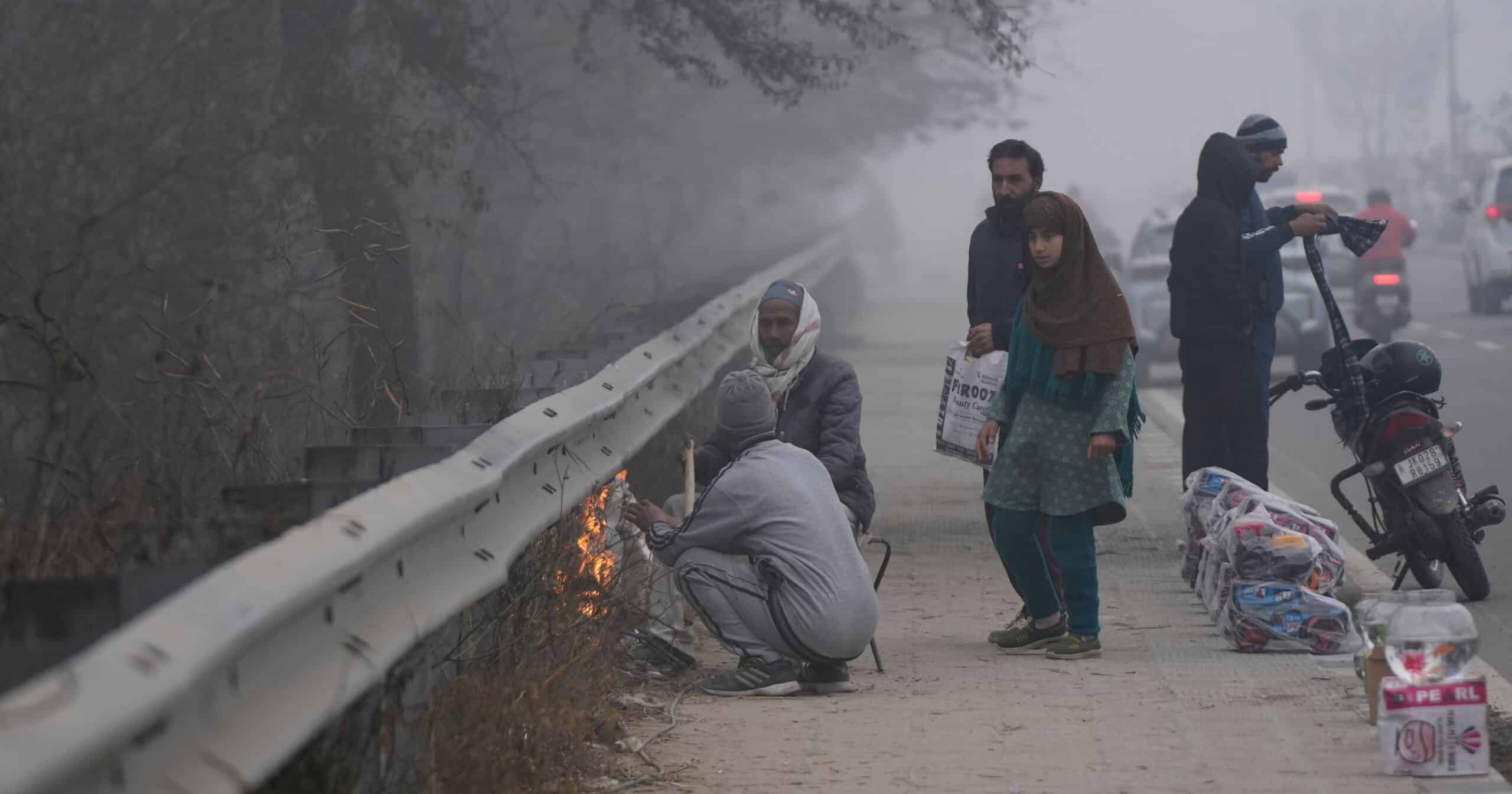
The India Meteorological Department (IMD) and media reports show a cold condition affecting northern and central India, with unusually low temperatures and dense fog disrupting daily life. Delhi recorded one of its coldest January mornings in recent years, with temperatures dipping to 3.2°C on January 13.
Cities across Haryana, Punjab, and Rajasthan recorded near-freezing temperatures, while Gurugram, in the National Capital Region, registered a chilling 0.6°C, among its lowest readings in close to 50 years. Parts of northern India remained colder than several Himalayan hill towns.
Gujarat, where winters are usually mild, has been experiencing a rare cold spell, with night temperatures in Saurashtra and the central and southern regions dropping into the single digits. Minimum temperature below normal by 2-3°C was recorded at many places in Karnataka too.
Several factors are at play
Multiple factors influence the cold weather experienced in the Indian region during these days, atmospheric scientists explained. “One of the primary contributors is a high-pressure system over north-central India, typically characterised by cloud-free skies and cold, dry air,” said Vijaykumar P., an assistant professor at the Department of Environmental Sciences, University of Kerala. “In many parts of central India, negative anomalies are observed in both daily maximum and minimum temperatures, indicating unusually cold conditions during both day and night. This cold air flows southward, bringing chilliness to the southern states of India too.”
Regarding the cold conditions in south India, Vijaykumar explained that at present, winds over both the Arabian sea and the Bay of Bengal are predominantly northwesterly. These winds can carry cold, dry air from central Asia and the Indo-Gangetic plains deep into the subcontinent, suppressing the warmer influence of the oceans and cooling the atmosphere.
“Most regions over the Indian mainland and even adjacent oceanic areas remain largely cloud-free, except when low-pressure systems bring clouds. These clear-sky conditions facilitate rapid heat loss from the Earth’s surface after sunset, resulting in colder mornings. In addition, humidity levels are low, especially over inland regions, which further enhances heat loss, as water vapour acts as a greenhouse gas that traps heat.”
Other weather and geographic factors also contribute to the cold conditions in northern India. “The present cold wave conditions in northern India mark the approach of the western disturbances that bring cold air from northern latitudes to the Indian subcontinent,” explained Abhilash S., Head of the Department of Atmospheric Sciences at the Cochin University of Science and Technology (CUSAT).
Western disturbances (WD) are large weather systems that travel from west to east with the subtropical westerly jet. The jet stream is a fast-moving band of winds that flows about 30,000 feet (9 km) above Earth, near the boundaries between the tropics and mid-latitudes. In winter, it shifts southward over India, steering WDs across the region. The system carries cold, dry air deep into the subcontinent, shaping north India’s winter weather and cold waves.
WDs often pair with low-pressure systems near the surface over western and northern India. Most frequent from December to March, they deliver the bulk of rain and snow to the western Himalayas and shape winter weather across northern India, Pakistan, and the Tibetan Plateau. They can also lead to heavy snowfall, hail, dense fog, cloudbursts, avalanches, frost, and the cold waves that periodically grip the plains.
Warming influences
While acknowledging below-normal temperatures, IMD scientists, however, noted that WDs are changing. “Though five to seven WDs are formed every month, either they are weak or pass over India quickly without impacting the weather much. The WD-induced rain and snowfall activities are decreasing,” said IMD director general Mrutyunjay Mohapatra in a press conference. This is causing a trend of declining winter rains in northern India, even when foggy conditions prevail.
Scientists say the changes could be due to global warming. “Basically, climate change and global warming are also adding to this [trend of cold weather]; east-west circulation like jet streams that are blowing from west to east can meander to the lower latitudes and intrude into the tropical region,” Abhilash said.

Cold conditions are also linked to teleconnections — changing conditions in one part of the world affecting remote regions — that are as far away as the Arctic and the Pacific, as scientists note. “Arctic Warming Amplification — the abnormal warming of the Arctic region, reducing the temperature gradient between the tropics and polar regions — is one such influence. As the temperature gradient reduces, the jet stream may weaken, and sometimes it can flow in unstable wavy patterns that can meander and intrude into its lower latitudes,” Abhilash said.
Arctic amplification refers to the Arctic region warming significantly faster than the global average — often two or more times faster — due to climate change, primarily driven by the loss of sea ice and snow cover that reduces the region’s reflectivity (albedo) and accelerates local warming.
However, the Arctic is not the only distant influence shaping India’s winter weather, scientists note.
“La Niña is favouring the cold wave conditions, so that is also an important factor,” Abhilash said, referring to the Pacific influence over the current weather in India. El Niño and La Niña are the warm and cool phases of a natural climate cycle across the tropical Pacific called the El Niño-Southern Oscillation (ENSO). This cycle fluctuates irregularly every two to seven years, altering ocean temperatures and disrupting wind and rainfall patterns across the tropics. Currently, La Niña is expected to persist through the Northern Hemisphere winter, with a likely shift to ENSO-neutral conditions between January and March 2026.
“La Niña conditions — characterised by anomalously cool sea surface temperatures — persist in the Pacific ocean and also play a role in influencing temperature patterns over the Indian region,” Vijaykumar explained. “In the Arabian sea, particularly near its eastern boundary, neutral to cold sea surface temperature anomalies are present. This reduces the ocean’s ability to moderate air temperatures along the west coast of India.”
He noted that there could also be the indirect influence of the weakening of the polar vortex in the Arctic region. When the polar vortex weakens, extremely cold air from the polar regions can spill into mid-latitudes, contributing to cold conditions over Europe, North America, and parts of central Asia. This occurs through large meanders in the jet stream, known as Rossby waves, which allow cold air to plunge equatorward.
When the polar vortex weakens, extremely cold air from the polar regions spills into mid latitudes, contributing to cold conditions over Europe, North America, and parts of central Asia. This happens through large meanders in the jet stream called Rossby waves. They allow cold air to plunge towards the equator.
The latest forecasts point to a fresh disruption of the polar vortex, triggered by a stratospheric warming event confirmed in mid-January. High-resolution models now depict a faltering polar circulation allowing Arctic air to spill south across North America and Europe. But when it weakens or fractures, that cold is no longer contained. It pours outward, reshaping the weather far from the pole and ushering in a spell of cold spells across the mid-latitudes.
Banner image: Vendors keep themselves warm on a cold morning in Jammu in January 2026. (AP Photo/Channi Anand)


