
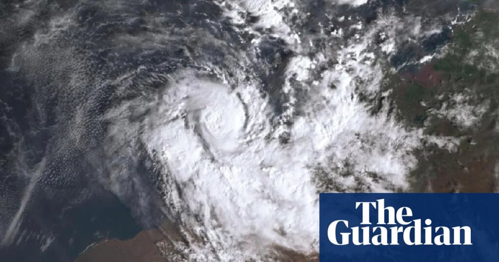
After a recent heatwave affected large parts of Australia before Christmas, Cyclone Hayley made landfall along the north-west coast on Tuesday night. Hayley formed on 28 December in the southern Indian Ocean and steadily intensified on a path south towards the north coast of Western Australia.
The system became a category 2 storm at its peak on Wednesday, with sustained winds of 105mph. After some weakening, Hayley crossed the Dampier peninsula near the town of Lombadina, still bringing intense winds and heavy rainfall. Hayley prompted a series of weather warnings from Australia’s Bureau of Meteorology, noting the potential for flash flooding and damage to property.
The affected area is a more sparsely populated part of Australia’s coastline, but despite this, two homes reportedly lost roofs, and roads were closed due to significant debris. The cleanup is expected to take weeks.
The north-west coast of Australia does experience the effects of cyclones, with the annual south Indian Ocean cyclone season running from October to May. December has turned into an active month for tropical cyclones in the waters surrounding Australia, with five storms so far this year including Hayley.
Meanwhile, in southern Spain there was extensive flooding across the Costa del Sol on the final weekend of 2025. Starting on Saturday 27 December, an area of low pressure just off the south-west coast of the Iberian peninsula brought heavy rain to southern Portugal and Spain throughout the day. The centre of the low-pressure system then swung around towards the strait of Gibraltar, pushing heavy rain across southern and south-east Spain through Saturday night and much of Sunday.
Streets became rivers and cars were carried away in a slurry of debris and water across Malaga, before the rain eased by Monday. Three people have been reported dead in the region.